NEW ORLEANS, LA.— The City of New Orleans and the Federal Emergency Management Agency (FEMA) are set to host a flood insurance workshop for the public in September. Residents and other property owners are encouraged to attend to gain a better understanding of how recent flood map changes will affect their flood insurance. The Sept.15 workshop is free, but seating is limited, so attendees must register in advance. For more information and to register, visit www.OrleansParishFloodWorkshop.eventbrite.com.

The proposed Flood Insurance Rate Maps (FIRMs) for Orleans Parish are finalized and will become the effective maps on Sept. 30, 2016. These maps are available online at www.Maps.RiskMAP6.com. Residents can view information about their property by navigating to their state, parish and local address.

FEMA is holding a similar, more technical workshop for insurance and real estate professionals tomorrow, Friday, Aug. 26 at City Hall. Registration for this event is now closed. Residents, renters and property owners are encouraged to register for the Sept. 15 flood insurance workshop.

About FEMA Risk MAP
New flood maps are developed as part the FEMA Risk Mapping, Assessment and Planning (Risk MAP) program. Risk MAP assists communities nationwide to assess flood risks and engage in mitigation planning to avoid or minimize damage in the face of future disasters. Through more precise flood maps, risk assessment tools and outreach support, Risk MAP strengthens local communities’ ability to make informed decisions about reducing risk.

FEMA’s mission is to support our citizens and first responders to ensure that as a nation we work together to build, sustain, and improve our capability to prepare for, protect against, respond to, recover from, and mitigate all hazards. Follow us on Twitter at http://twitter.com/femaregion6, and the FEMA Blog at http://blog.fema.gov.

See original: 

Flood Insurance Workshop for residents to be hosted by FEMA and City of New Orleans

SEATTLE, Wash. – With so many people on the move for the holidays, FEMA’s regional office in the Pacific Northwest is running two week-long social media campaigns to encourage holiday travelers to stay safe Nov. 22 – 28, and Dec. 20 – 26. The campaign has tips for families, pet owners, smartphone users, and people traveling domestically by car and plane, and internationally.  

Here are three tips from the campaign:

  • Pack a small emergency kit for your suitcase. Batteries, a flashlight, a portable radio and USB power bank are good items to start with.
  • Download FEMA’s app, which lets you receive with weather alerts for up to five locations – set one for your holiday destination to stay informed.
  • Use STEP, the Department of State’s the Smart Traveler Enrollment Program if you’re traveling abroad. This will help the U.S. Embassy contact you in an emergency in the event of a natural disaster, civil unrest or family emergency.

This campaign a combined effort with partners in Alaska, British Columbia, Idaho, Oregon and Washington. You can get these tips from FEMA’s Twitter account @FEMARegion10 and Facebook page, and by watching the hashtag #SmartTravels.

More:

FEMA’s Pacific Northwest Region wishes you #SafeTravels for the holidays

CHICAGO –Disasters can happen with little or no warning, but that doesn’t mean you can’t be ready for them. Use these five life hacks to help you better prepare for whatever the unexpected may be:

1. Take small steps toward building your emergency supply kit. Pick up a couple of extra bottles of water and cans of non-perishable food the next time you’re at the grocery store. When you buy replacement batteries for the remote control, set aside a few extras along with a flashlight. Small purchases such as these will eventually help you create a robust emergency supply kit that could be vital to survive on your own after an emergency. If you’re wondering what supplies you might need to stock up on, reference Ready.gov’s Recommended Supply List.
 
3. Get and stay connected with the ones you love. If your family members aren’t together in an emergency and telephone circuits are jammed, does everyone know what to do? If the answer is no, go to Ready.gov’s Family Communications Plan to help you get started collecting and sharing the important information your family may need in the event of an emergency. Make sure everyone knows where to go and who to contact so you never have to worry about your family’s safety after a disaster.
 
3. Make your smartphone a lifesaving tool. FEMA’s App can be downloaded to keep you aware of impending severe weather for up to five locations across the U.S., along with customized information to stay safe and other readiness resources to help you prepare for potential disasters. 
 
4. Get smart… Everyone lives in a flood zone – but do you know whether your home is located in a high- or low- to moderate-flood risk area? If not, FEMA’s FloodSmart page has a One-Step Flood Risk Profile tool where you can enter your address and find out. Learn about all of the disaster risks unique to your community—and any location you may visit or spend time—so you’re not caught unaware if something were to occur. Visit America’s PrepareAthon! page and get educated about the specific hazards in any area you choose.
 
5. Then act the part! Once you know the type of disasters most common to your community, take steps to reduce your risk. Talk to your insurance agent and verify you’re fully covered – did you know homeowner’s insurance doesn’t cover flood damage? What about the fact that sewer backup damage is typically covered by a rider added to your homeowner’s coverage? You can also mitigate disaster risks by taking other simple steps like storing important papers in a safe place, elevating mechanicals off the floor of your basement to avoid potential flood damage and caulking exterior openings where electrical wires and cables enter your home to keep water from getting inside. Learn more about risk reduction techniques by visiting FEMA’s Protecting Homes webpage.

For even more readiness information follow FEMA Region V at twitter.com/femaregion5 and www.facebook.com/fema. Individuals can always find valuable preparedness information at www.Ready.gov.

FEMA’s mission is to support our citizens and first responders to ensure that as a nation we work together to build, sustain, and improve our capability to prepare for, protect against, respond to, recover from, and mitigate all hazards.

Follow FEMA online at twitter.com/femaregion5, www.facebook.com/fema, and www.youtube.com/fema.  Also, follow Administrator Craig Fugate’s activities at twitter.com/craigatfema. The social media links provided are for reference only. FEMA does not endorse any non-government websites, companies or applications.

###

Media Contact: Cassie Ringsdorf, (312) 408-4455
 

View this article:  

Five Disaster Prep Hacks You Need to Know

Cannon Beach, Ore. – This past weekend, Cannon Beach held its second annual Race the Wave run for tsunami preparedness.  FEMA Corps provided support for the event along with several local and regional partners.  The team of eight FEMA Corps members, known as Blue Two, is serving in the FEMA Region X office in Bothell, Washington.  Blue Two arrived in Bothell September 3rd and will be in the area until November 12th.Their previous projects included a supporting role with the Central Coast Red Cross in California and FEMA Region VI in New Orleans, Louisiana.

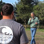
Mayor Steidel of Cannon Beach speaks at the starting line of Race the Wave at Necus' Park.

Cannon Beach Mayor Sam Steidel speaks to partners and participants prior to Race the Wave.  In its second year the event continues to spread a message of tsunami preparedness.  The event ended at one of the cities cache storage sites, where there was a preparedness fair open to race participants and the local community.

Race the Wave gave participants the option of running, walking, or rolling through different courses that began at the beach, leading onto the tsunami evacuation route and up to the designated assembly area, where they finished at a Disaster Preparedness Fair. The Preparedness Fair featured fun and interactive booths from various organizations including the American Red Cross and the Oregon Office of Emergency Management (OEM) for families and persons of all ages to learn how to properly prepare for a potential earthquake and tsunami.

Cannon Beach is a prime location for the event since it is a coastal community with a high volume of tourism year round.  However, despite being community based for the past two years, its intention is to send a broader message about the prevalent tsunami hazard along coastlines.  Populations vulnerable to this type of disaster stretch from Alaska all the way down to the coast of California. FEMA Region X hopes this event and others like it will encourage communities to become active in preparedness and spread the message. 

Cannon Beach is home to a cache storage system that is stocked and maintained by its citizens.  Mayor Sam Steidel had this to say on their system, “Involving our citizens in community preparedness gives us an educated volunteer base that will be of great importance in the event of emergencies.  In the future we hope to seek further improvement in our efforts by cooperating with other coastal communities for outreach events like Race the Wave.”

Blue Two assisted the Cannon Beach Children’s Center and Clatsop County Emergency Management with logistical efforts including race route support and gathering content for social media.  The team found collaborative efforts between organizations to be interesting, such as the Oregon Office on Disability & Health to the Oregon Department of Geology and Mineral Industries.  The team was eager to participate in the event understanding the potential impact it could have.

The AmeriCorps National Civilian Community Corps (NCCC) and its FEMA Corps units engage 2,800 young Americans in a full-time, 10-month commitment to service each year. AmeriCorps NCCC members address critical needs related to natural and other disasters, infrastructure improvement, environmental stewardship and conservation, and urban and rural development; FEMA Corps members are solely dedicated to disaster preparedness, mitigation, response and recovery work. The programs are administered by the Corporation for National and Community Service (CNCS). CNCS is the federal agency that engages more than five million Americans in service through its AmeriCorps, Senior Corps, Social Innovation Fund, and Volunteer Generation Fund programs, and leads President’s national call to service initiative, United We Serve. For more information, visit NationalService.gov.

Visit source – 

FEMA Corps ‘Raced the Wave’ in Cannon Beach

EATONTOWN, N.J. – Whether you just moved into your neighborhood a week ago or you’ve lived there for 25 years, getting to know your neighbors has always been an important part of a functioning society. It can also be helpful in a crisis, because after a disaster occurs, the people in closest proximity to you – and the people who will be able to help you most immediately – are your neighbors.

They may need your help as well. Research reported by FEMA says that people often are not as prepared for disasters as they think they are. Forty percent of survey respondents said they did not have household plans in the event of an emergency, and nearly 60 percent did not know their community’s evacuation routes. Almost 20 percent of responders said they had a functional disability that would affect their ability to respond during a disaster, but only 25 percent of those people have made arrangements to or alerted others to their disability in case of an event. In a different survey, 46 percent of people said they expect to rely on people in their neighborhood for assistance in the first 72 hours after a disaster.

There are several ways to find out what you can do to help. If you live in an area that is known for disaster events or has had them recently, it can be as simple as asking them how they dealt with any previous incidents. Their feedback can teach you what precautions are the most effective for the situation.

You can also organize your neighbors with the help of local service groups such as Citizen Corps Councils, Neighborhood Watch teams, Community Emergency Response Teams (CERT), as well as local fire and police departments and emergency management agencies. Their input can help you figure out your neighborhood’s biggest needs.

FEMA also recommends hosting meetings with family, friends and neighbors to plan service projects, set service goals, and learn about existing local emergency response plans. Community-based organizations often lack the capacity to manage large numbers of volunteers, so they need individuals to organize themselves and work alongside them.

The Community Preparedness Toolkit, available at www.ready.gov, offers specific steps and links to resources to help you take a proactive role in making your neighborhood safer, more resilient and better prepared.

FEMA’s mission is to support our citizens and first responders to ensure that as a nation we work together to build, sustain, and improve our capability to prepare for, protect against, respond to, recover from, and mitigate all hazards.

Follow FEMA online at www.twitter.com/FEMASandywww.twitter.com/fema, www.facebook.com/FEMASandy, www.facebook.com/fema, www.fema.gov/blog, and www.youtube.com/fema. Also, follow Administrator Craig Fugate’s activities at www.twitter.com/craigatfema

The social media links provided are for reference only. FEMA does not endorse any non-government websites, companies or applications

View article: 

Know Your Neighbors, Get Involved In Community Preparedness

Portland, Ore. – Gear up for the third annual Portland Disaster Relief Trials (DRT), taking place this upcoming Saturday, July 19. This 30-mile earthquake preparedness exercise is designed to highlight how cargo bikes can be used in disaster supply runs, helping mitigate some of the fuel and transportation problems that typically affect cars and other vehicles after major earthquakes.

The scenario for the DRT is to focus on day four after a major earthquake. Cyclists, without cell phones, must navigate their own route between checkpoints while picking up 100 pounds of supplies and completing disaster-related activities. This makeshift course consists of an off-pavement portion, a one-meter obstacle, and at least one shallow water crossing. Not to mention, bikes will be carrying varied types of supplies that range in size and weight. Finding the most efficient way to fasten and carry the cargo “is a hallmark of the Disaster Relief Trials.”

This year, seeing the cargo bikes race is not the only reason to go. There will be a huge cargo bike fair, complete with family-friendly activities and events that will be going on throughout the day. The event’s host, the Oregon Museum of Science and Industry (OMSI), has partnered with another major Portland biking event, Fiets of Parenthood, to create a fun family bicycle obstacle course.

A proud supporter of the Disaster Relief Trials, the Federal Emergency Management Agency’s Region X staff and FEMA Corps team will be supporting the event, providing earthquake preparedness information, interactive activities, and full-size earthquake hazard map.

Portland DRT will be this Saturday, July 19, 2014 at the OMSI building from 11 a.m.-5 p.m. Follow @femaregion10 on Twitter as they live tweet from the event. For more information about the 2014 Disaster Relief Trials, go to http://drtpdx.org/.

FEMA’s mission is to support our citizens and first responders to ensure that as a nation we work together to build, sustain, and improve our capability to prepare for, protect against, respond to, recover from, and mitigate all hazards.


# # #

Link: 

Portland Disaster Relief Trials Pedal for Earthquake Preparedness

MONTGOMERY, Ala. ‒ Homeowners and business owners who experienced flooding during the April 28 to May 5 presidentially declared disaster should file a claim for flooding loss as soon as possible, as claimants must file for their losses within 60 days of the event. 

Contact your agent or insurance company to file a claim. An adjuster from the insurance company should contact you within a few days of filing a claim. If you do not hear from an adjuster, call your insurance agent or company again. Make sure you have the following information handy:

  • The name of your insurance company.
  • Your policy number.
  • A telephone and/or email address where you can be reached at all times.

Remember, a flood insurance policy is usually separate from your homeowner’s policy, which in most cases does not pay for flood claims.

Next, separate damaged from undamaged property. Your adjuster will need evidence of the damage to your home and possessions to prepare your repair estimate.

  • Take photographs of all damaged property, including discarded objects, structural damage and standing floodwater levels.
  • Make a list of damaged or lost items and include their date of purchase, value and receipts, if possible.
  • Officials may require disposal of damaged items, so if possible, place flooded items outside of the home.

Finally, your adjuster will provide you with a Proof of Loss form for your official claim for damages. Remember, you must file this claim with your insurance company within 60 days of the flood – or by the end of June.

This document substantiates the insurance claim and is required before the National Flood Insurance Program or insurance company can make payment.

You will receive your claim payment after you and the insurer agree on the amount of damages and the insurer has your complete, accurate and signed Proof of Loss form. If major catastrophic flooding occurs, it may take longer to process claims and make payments due to the sheer number of claims submitted.

For general flood insurance questions, call the National Flood Insurance Call Center at 800-427-4661directly or through 711 Relay or contact your insurance company or agent.


Excerpt from:

Don’t Forget to File a Flood Insurance Claim

DENTON, Texas –– New flood maps for specific areas of Montgomery County, Texas will become effective five months from now, on Monday, Aug. 18, 2014. Local and federal officials encourage everyone in the county to view the maps to understand their flood risk and consider buying flood insurance before then.

Most property insurance policies do not cover the effects of a flood. Floods can place people at risk of uninsured loss to their businesses, homes and personal property if they don’t have either a private flood insurance policy or coverage through the National Flood Insurance Program (NFIP), a voluntary protection program administered by the Federal Emergency Management Agency (FEMA).

Flooding is the #1 natural disaster in the United States and only flood insurance covers these unexpected, damaging and sometimes fatal events. “Wherever it rains, it can flood,” said FEMA Region 6 Administrator Tony Robinson. “Everyone lives in a flood zone.”

To learn if your community participates in the NFIP and to review the new flood maps, residents can contact their local floodplain administrator. 

Montgomery County maps on riskmap6.com have been updated to reflect appeal resolutions.
FEMA map specialists and flood insurance experts also are available to answer questions. They can be reached by phone and online chat:

• View the maps online at  http://maps.riskmap6.com/TX/Montgomery
• To use the live chat service, visit http://go.usa.gov/r6C.  Click on the “Live Chat” icon.
• To contact a FEMA Map Specialist, call 1-877-FEMA MAP (1-877-336-2627) or send an email to FEMAMapSpecialist@riskmapcds.com.
                                                
FEMA encourages communities not currently participating in the NFIP to look at the benefits of joining the program. Participation in the NFIP can assure a faster recovery in the event of a devastating flood. Contacting a local insurance agent is the first step to obtaining information about insurance. Folks can visit www.floodsmart.gov or call 1-888-379-9531 to locate an agent in their area.                                         
                                                       

FEMA’s mission is to support our citizens and first responders to ensure that as a nation we work together to build, sustain, and improve our capability to prepare for, protect against, respond to, recover from, and mitigate all hazards.    Follow us on Twitter at www.twitter.com/femaregion6 and the FEMA Blog at http://blog.fema.gov.

Continued: 

Five Months Remain Before Montgomery County, TX Flood Maps Become Final

DENTON, Texas –– New maps for specific areas of Travis County, Texas will become effective on Monday, Aug. 18, 2014. Local and federal officials encourage everyone in the affected area to view the maps to understand their flood risk and consider buying flood insurance before then.

Most property insurance policies do not cover the effects of a flood. Floods can place people at risk of uninsured loss to their businesses, homes and personal property if they don’t have either a private flood insurance policy or coverage through the National Flood Insurance Program (NFIP), a voluntary protection program administered by the Federal Emergency Management Agency (FEMA).

Flooding is the #1 natural disaster in the United States and only flood insurance covers these unexpected, damaging and sometimes fatal events. “Wherever it rains, it can flood,” said FEMA Region 6 Administrator Tony Robinson. “Everyone lives in a flood zone.”

To learn if your community participates in the NFIP and to review the new flood maps, residents can contact their local floodplain administrator. 

FEMA map specialists and flood insurance experts also are available to answer questions. They can be reached by phone and online chat:

• To use the live chat service, visit http://go.usa.gov/r6C.  Click on the “Live Chat” icon.
• To contact a FEMA Map Specialist, call 1-877-FEMA MAP (1-877-336-2627) or send an email to FEMAMapSpecialist@riskmapcds.com.

FEMA encourages communities not currently participating in the NFIP to look at the benefits of joining the program. Participation in the NFIP can assure a faster recovery in the event of a devastating flood. Contacting a local insurance agent is the first step to obtaining information about insurance. Folks can visit www.floodsmart.gov or call 1-888-379-9531 to locate an agent in their area.
                                               

FEMA’s mission is to support our citizens and first responders to ensure that as a nation we work together to build, sustain, and improve our capability to prepare for, protect against, respond to, recover from, and mitigate all hazards. Follow us on Twitter at www.twitter.com/femaregion6 and the FEMA Blog at http://blog.fema.gov.

Link: 

Five Months Remain Before Travis County, TX Flood Maps Become Final

DENTON, Texas –– New flood maps for specific areas of Dallas County will become effective on Monday, July 7, 2014. Local and federal officials encourage everyone to view the maps to understand their flood risk and consider purchasing flood insurance before then.

Most property insurance policies do not cover the effects of a flood. Floods can place people at risk of uninsured loss to their businesses, homes and personal property if they do not have either a private flood insurance policy or coverage through the National Flood Insurance Program (NFIP), a voluntary protection program administered by the Federal Emergency Management Agency (FEMA).

Flooding is the number one natural disaster in the United States and only flood insurance covers these unexpected, damaging and sometimes fatal events.

“Where there is rain, there could be flooding,” said FEMA Region 6 Administrator Tony Robinson. “Everyone lives in a flood zone.”             

To review the new flood maps, residents can contact their local floodplain administrator. An interactive mapping portal is also available. FEMA map specialists and flood insurance experts are available to answer questions and can be reached by phone and email:

• To view the maps on an interactive flood information portal, visit http://maps.riskmap6.com/TX/Dallas
• To view the Preliminary Interactive Flood Map Index online visit http://www.riskmap6.com/documents/Meeting_263/48113CIND0D.pdf
• To contact a FEMA Map Specialist, call 1-877-FEMA MAP (1-877-336-2627) or send an email to FEMAMapSpecialist@riskmapcds.com.
• To use the live chat service, visit http://go.usa.gov/r6C.  Click on the “Live Chat” icon

Participation in the NFIP can assure a faster recovery in the event of a devastating flood. Contacting a local insurance agent is the first step to obtaining information about insurance. Residents can visit www.floodsmart.gov or call 1-888-379-9531 to find an agent near them.
                                              

FEMA’s mission is to support our citizens and first responders to ensure that as a nation we work together to build, sustain, and improve our capability to prepare for, protect against, respond to, recover from, and mitigate all hazards.    Follow us on Twitter at www.twitter.com/femaregion6 and the FEMA Blog at http://blog.fema.gov.

See more here – 

Four Months Remain Before Flood Maps For Specific Areas of Dallas County, Texas Become Final

 Page 1 of 3  1  2  3 »